The Project
Mapconception is an on-going collaboration between Arzu Arda Kosar and Deb Diehl, who share a fascination with the historical cartography of Los Angeles County. We're interested in the ways psychological perceptions influence the practice of mapping, and how it continues to shape ideas of ownership and belonging in communities.
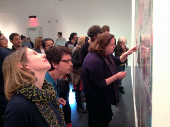
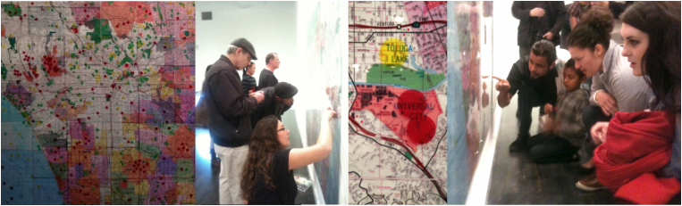
We've made and have exhibited several maps where viewers are invited to participate. Each map encourages a particular historical or psychological examination of LA county, and allows viewers to record their ideas and relationship to it.
We are currently working on projects that will incorporate a series of videos, shot at the boundaries of former Spanish and Mexican era Ranchos, and an on-line interactive psychogeographical map.
The 2D Maps
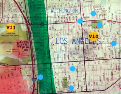
The "Harbor Map" depicts the area in and around Rancho San Pedro, the first California land grant "given" in 1784 by the Spanish government to one of its Spanish soldiers. The map is made of three 4' X 6' layers of plexiglass that overlay in the following manner:
Background Layer: Thomas Guide maps of currently Los Angeles County and city boundaries.
Layer 2: Chumash and Tongva Native American Villages est. between 7000-8000 BC (Yellow Dots)
Layer 3: Boundaries for five of the first land grants established in 1784.
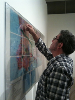
Topmost Layer: Interactive layer where members of the South Bay were invited to demarcate where they live.
Background Layer: Thomas Guide maps of currently Los Angeles County and city boundaries.
Layer 2: Chumash and Tongva Native American Villages est. between 7000-8000 BC (Yellow Dots)
Layer 3: Boundaries for five of the first land grants established in 1784.
Topmost Layer: Interactive layer where members of the South Bay were invited to demarcate where they live.
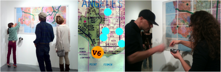
Terra Incognita
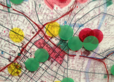
Terra Incognita means the "unexplored or unknown territory". For our 9' X 12' "Terra Incognita Map" we asked viewers to mark areas of central LA County according to three criteria:
•Places they they consider Terra Incognita and didn't want to go to or explore
•Places they they consider Terra Incognita and wanted to go to or explore
•Places they know well and feel comfortable in
Future Work
We intend to continue creating of maps with the help of community residents from each region of LA County. If your school or organization is interested in hosting or participating in the project, please contact us!
[email protected]
[email protected]
